(across from RW Combs School) –
Directions to property: Leaving HDA, turn left on 476 south for 2.8 miles to 15 South for 8 miles. Turn left on Ben Town Circle Road for .02 mile. Property on the left. Size approximately 109’ X 114’. City water available.
Lat. 37.205533
Long. -83.106304

(landowner: Carlo White) –
Directions to property: Leaving Housing Development Alliance, turn left on 476 passing through town for 2.9 miles. Go straight on 15 South for 1.6 miles. Turn left on 1096 Fourseam Road for 3.9 miles. Turn left on Buffalo Run Road for 1.2 miles. Property on the right.
Latitude 37.184847 Longitude -83.202732
Directions to property: In Walkertown, turn up the hill on Plum Street at KFC. Drive up the hill and turn right onto Carter Street. NOT counting the house on the corner, the property is the 2nd house on the right. We will be tearing down the existing house and building a new house on the same “footprint.”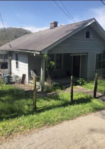

VERY NICE PROPERTY!
LOWER PIGEONROOST –
Directions to property: Leaving HDA, turn right on 476 for 0.7 mile. Turn left on 580/old 80 for 1.2 miles. Turn right on Crawford Mountain Road for 0.6 mile. Turn right on 15 North for 2.1 miles. Turn left on Lower Second Creek for 1.2 miles. Turn right on Flat Gap Road for 0.9 mile, then turn left on Lower Pigeon Roost for 0.5 mile. Turn left on Chance Way Property on the left at the end of the road.
LAT 37.294322
LONG -83.274370
Directions to property: Leaving Housing Development Alliance, turn right on 476 North for .03 miles. Go straight on 550 East for 2.2 mile, turn left on 1146 Hiner for 1.2 miles. Turn left on 80 West for .04 mile, turn right on 1146 North for 2.3 miles, turn right beside Blair Memorial Baptist Church. Property is behind the church.
LAT 37.337595,
LONG -83.182217
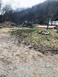
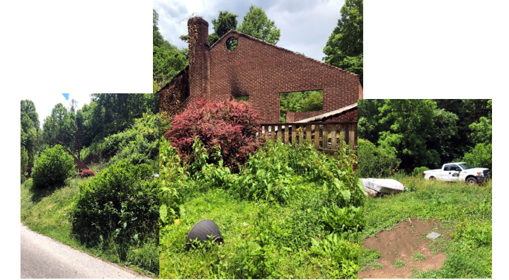
Big Creek –
Directions to property: Exit the Hal Rogers Parkway at Exit 56 and turn toward old Hwy 80 (away from Brownsfork/Hazard). At the T intersection, turn left onto Hwy 80. Drive 2.3 miles and turn left onto Big Creek Road (Hwy 1096). Drive just over a mile and turn left onto Polly Hollow. Robert Lane is your first right. Property is on the right as you turn up Robert Lane. Property is now cleared.
(Lat 37.221737,
Long -83.254336)
Brownsfork Road –
Directions to property: From HDA, turn right on 476 North for .07 miles. Turn left on 550 and old 80 for 6.2 miles. Turn left on 451 South for 1 mile. Turn right on Brown’s Fork Road for .08 mile. Turn left on Sugar Hollow for 500’. Turn left on Sugar Ridge for .08 miles to top of the mountain. Property on the left.
LAT 37.242655,
LONG -83.233091
Directions to property: From HDA, turn right on 476 North for 2.9 miles. Turn left on 1146 (Hiner) for 1.2 miles. Turn right on 80 East for 2.3 miles. Turn left on Red Star Mountain Road for .01 mile. Turn left on Turkey Knob Lane for .01 mile. Property on the right.
LAT 37.345266,
LONG -83.143645

Directions to property: Take 15 South from Hazard crossing dam at Carr Creek. Turn Left onto 1231 North for 4.1 miles, turn left at top of mountain, follow gravel road for .03 miles. Property on right at gate.
Latitude 37.287134 Longitude -83.000978
Directions will be posted soon.


Directions to property: From HDA, Inc., turn right onto North Main Street/Hwy 476. Go 1.7 miles and turn right onto Lotts Creek Road (Hwy 1088 E). Go 5.6 miles and turn left onto Jacks Branch Road. It will be 0.5 miles past the Knott County line. Go 0.1 miles and the property is on the left.
